![](/images/other/stat-length.png)
![Excursión Senderismo Mont Lozère et Goulet - Lozère j 4 - Photo](https://media.geolcdn.com/t/1900/400/ext.pjpeg?maxdim=2&url=https%3A%2F%2Fstatic1.geolcdn.com%2Fsiteimages%2Fupload%2Ffiles%2F1553511878bg_sport_marche.png)
Lozère j 4
rigol05
Usuario
![Longitud](/images/other/stat-length.png)
Longitud
17,9 km
![Altitud máxima](https://static1.geolcdn.com/siteimages/upload/files/1508320355ic_sort_altitude_max_24dp.png)
Altitud máxima
1413 m
![Desnivel positivo](https://static1.geolcdn.com/siteimages/upload/files/1508320355ic_sort_den_pos_24dp.png)
Desnivel positivo
527 m
![Km-Effort](/images/other/stat-length.png)
Km-Effort
25 km
![Altitud mínima](https://static1.geolcdn.com/siteimages/upload/files/1508320355ic_sort_altitude_min_24dp.png)
Altitud mínima
1071 m
![Desnivel negativo](https://static1.geolcdn.com/siteimages/upload/files/1508320355ic_sort_den_neg_24dp.png)
Desnivel negativo
615 m
![Boucle](https://static1.geolcdn.com/siteimages/upload/files/16400158638029165_repeat_loop_refresh_sync_direction_icon.png)
Boucle
No
Fecha de creación :
2015-07-05 00:00:00.0
Última modificación :
2015-07-05 00:00:00.0
![Senderismo](https://static1.geolcdn.com/sitytour/trail-icons/101.png)
5h16
Dificultad : Medio
![Escanee este código QR para abrir la excursión en la aplicación SityTrail](https://capi.geolives.com/qq0zvz2zws4bq2lad0pu/sitytour/trails/441520/qr.png?size=200)
Aplicación GPS de excursión GRATIS
A propósito
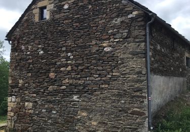
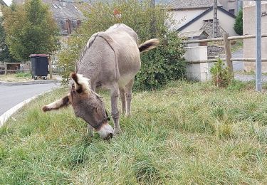
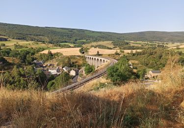
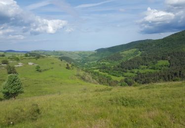
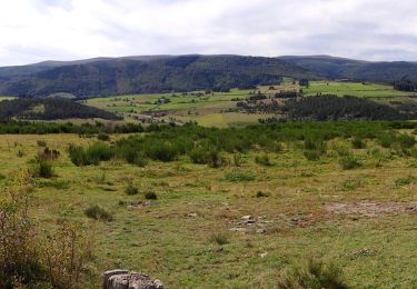
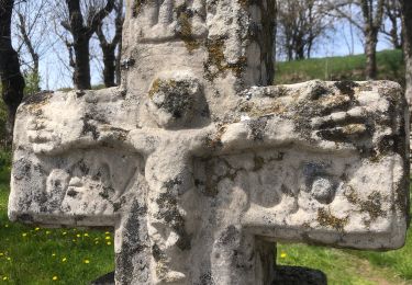
Ruta Senderismo de 17,9 km a descubrir en Occitania, Lozère, Mont Lozère et Goulet. Esta ruta ha sido propuesta por rigol05.
Descripción
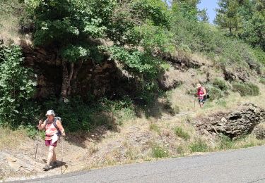
Etape Chasseradès le Bleymard.Beaucoup de route et de piste rendant le parcours un peu lassant
Localización
País:
France
Región :
Occitania
Departamento/provincia :
Lozère
Municipio :
Mont Lozère et Goulet
Localidad:
Unknown
Salida:(Dec)
Salida:(UTM)
565596 ; 4933331 (31T) N.
Comentarios
Excursiones cerca
![Excursión Senderismo Mont Lozère et Goulet - Stevenson étape 7 - Photo](https://media.geolcdn.com/t/375/260/ca5e79f2-b988-472d-b1a4-865ced3314e1.jpg&format=jpg&maxdim=2)
![Senderismo Senderismo](https://static1.geolcdn.com/sitytour/trail-icons/101.png)
Stevenson étape 7
Senderismo
Difícil
Mont Lozère et Goulet,
Occitania,
Lozère,
France
![](/images/other/stat-length.png)
20 km | 28 km-effort
4h 57min
![](https://static1.geolcdn.com/siteimages/upload/files/16400158638029165_repeat_loop_refresh_sync_direction_icon.png)
No
![Excursión Senderismo Mont Lozère et Goulet - Stevenson Chasseradès - Le Bleymard - Photo](https://media.geolcdn.com/t/375/260/084f4a90-f605-49e0-8cc1-95e8aee0296f.jpg&format=jpg&maxdim=2)
![Senderismo Senderismo](https://static1.geolcdn.com/sitytour/trail-icons/101.png)
Stevenson Chasseradès - Le Bleymard
Senderismo
Muy difícil
Mont Lozère et Goulet,
Occitania,
Lozère,
France
![](/images/other/stat-length.png)
21 km | 29 km-effort
5h 4min
![](https://static1.geolcdn.com/siteimages/upload/files/16400158638029165_repeat_loop_refresh_sync_direction_icon.png)
No
![Excursión Senderismo Mont Lozère et Goulet - le Bleymard - Photo](https://media.geolcdn.com/t/375/260/a7e52d95-c918-4024-aa49-8bd4f60cbf65.jpg&format=jpg&maxdim=2)
![Senderismo Senderismo](https://static1.geolcdn.com/sitytour/trail-icons/101.png)
le Bleymard
Senderismo
Muy difícil
Mont Lozère et Goulet,
Occitania,
Lozère,
France
![](/images/other/stat-length.png)
17,3 km | 25 km-effort
5h 14min
![](https://static1.geolcdn.com/siteimages/upload/files/16400158638029165_repeat_loop_refresh_sync_direction_icon.png)
No
![Excursión Senderismo Mont Lozère et Goulet - Chasserades Bleymard - Photo](https://media.geolcdn.com/t/375/260/116a16c1-813e-45da-b910-05ff52927fe4.jpg&format=jpg&maxdim=2)
![Senderismo Senderismo](https://static1.geolcdn.com/sitytour/trail-icons/101.png)
Chasserades Bleymard
Senderismo
Difícil
Mont Lozère et Goulet,
Occitania,
Lozère,
France
![](/images/other/stat-length.png)
20 km | 28 km-effort
6h 57min
![](https://static1.geolcdn.com/siteimages/upload/files/16400158638029165_repeat_loop_refresh_sync_direction_icon.png)
No
![Excursión Senderismo Mont Lozère et Goulet - arsel chasserades au bleymard - Photo](https://media.geolcdn.com/t/375/260/93179cba-083a-4533-8ddb-80481acfe8eb.jpg&format=jpg&maxdim=2)
![Senderismo Senderismo](https://static1.geolcdn.com/sitytour/trail-icons/101.png)
arsel chasserades au bleymard
Senderismo
Muy fácil
Mont Lozère et Goulet,
Occitania,
Lozère,
France
![](/images/other/stat-length.png)
14,1 km | 21 km-effort
6h 14min
![](https://static1.geolcdn.com/siteimages/upload/files/16400158638029165_repeat_loop_refresh_sync_direction_icon.png)
No
![Excursión Bici de montaña Mont Lozère et Goulet - Chasserades Finiels 2020 - Photo](https://media.geolcdn.com/t/375/260/6b5f0140-2a52-469f-ac07-12640915fb18.jpg&format=jpg&maxdim=2)
![Bici de montaña Bici de montaña](https://static1.geolcdn.com/sitytour/trail-icons/202.png)
Chasserades Finiels 2020
Bici de montaña
Difícil
Mont Lozère et Goulet,
Occitania,
Lozère,
France
![](/images/other/stat-length.png)
48 km | 67 km-effort
5h 36min
![](https://static1.geolcdn.com/siteimages/upload/files/16400158638029165_repeat_loop_refresh_sync_direction_icon.png)
No
![Excursión Senderismo Mont Lozère et Goulet - Chasserades -Station Mont Lozère Stevenson - Photo](https://media.geolcdn.com/t/375/260/ext.jpg?maxdim=2&url=https%3A%2F%2Fservices.sitytrail.com%2FGeolivesWS%2FDownloadMedia.ashx%3FTrailID%3D769906%26Media%3Dfix__20170609174625.jpg)
![Senderismo Senderismo](https://static1.geolcdn.com/sitytour/trail-icons/101.png)
Chasserades -Station Mont Lozère Stevenson
Senderismo
Difícil
(1)
Mont Lozère et Goulet,
Occitania,
Lozère,
France
![](/images/other/stat-length.png)
25 km | 37 km-effort
7h 47min
![](https://static1.geolcdn.com/siteimages/upload/files/16400158638029165_repeat_loop_refresh_sync_direction_icon.png)
No
![Senderismo Senderismo](https://static1.geolcdn.com/sitytour/trail-icons/101.png)
GR_70_AG_07_Mont-Lozere-Goulet_Cubieres_20140921
Senderismo
Muy difícil
Mont Lozère et Goulet,
Occitania,
Lozère,
France
![](/images/other/stat-length.png)
19,8 km | 30 km-effort
6h 12min
![](https://static1.geolcdn.com/siteimages/upload/files/16400158638029165_repeat_loop_refresh_sync_direction_icon.png)
No
![Excursión Senderismo Mont Lozère et Goulet - 20230405 Chasserades-le Bleymard - Photo](https://media.geolcdn.com/t/375/260/b832b3bb-1b81-4f6a-812b-f75e16b8837f.jpg&format=jpg&maxdim=2)
![Senderismo Senderismo](https://static1.geolcdn.com/sitytour/trail-icons/101.png)
20230405 Chasserades-le Bleymard
Senderismo
Fácil
Mont Lozère et Goulet,
Occitania,
Lozère,
France
![](/images/other/stat-length.png)
18,7 km | 26 km-effort
4h 32min
![](https://static1.geolcdn.com/siteimages/upload/files/16400158638029165_repeat_loop_refresh_sync_direction_icon.png)
No